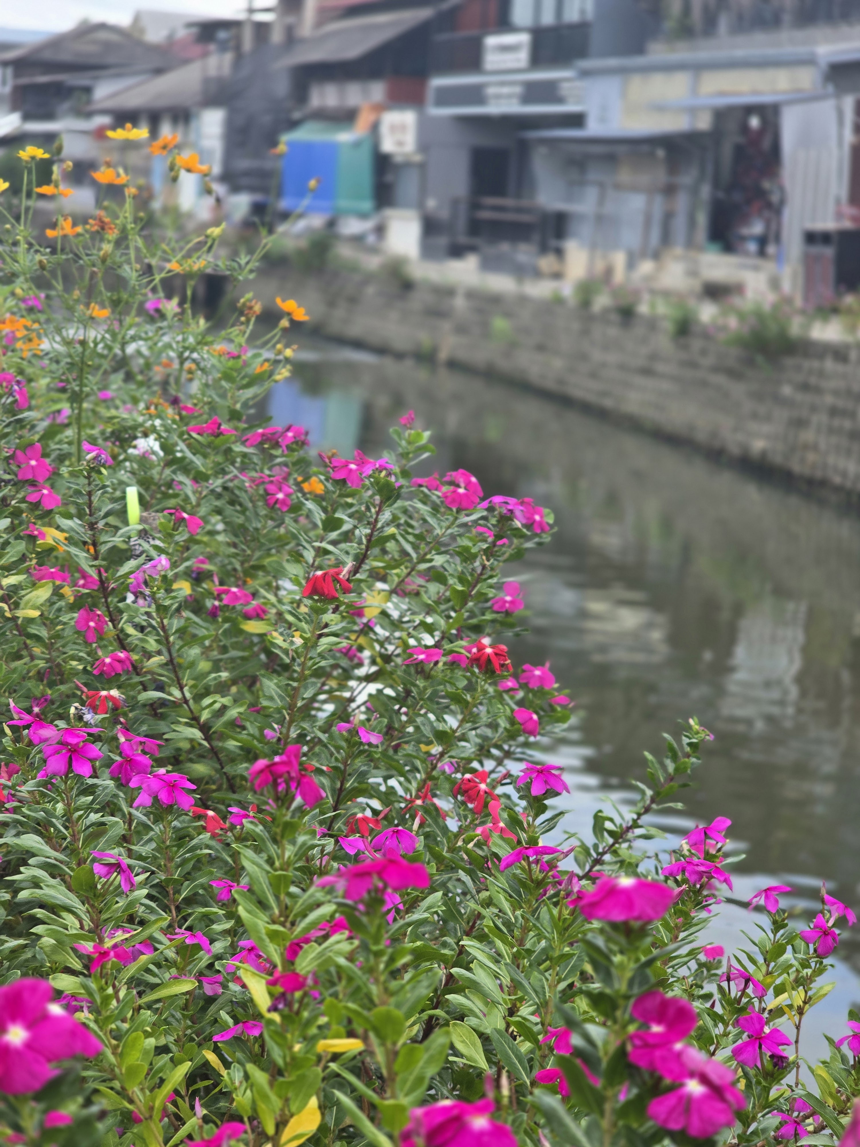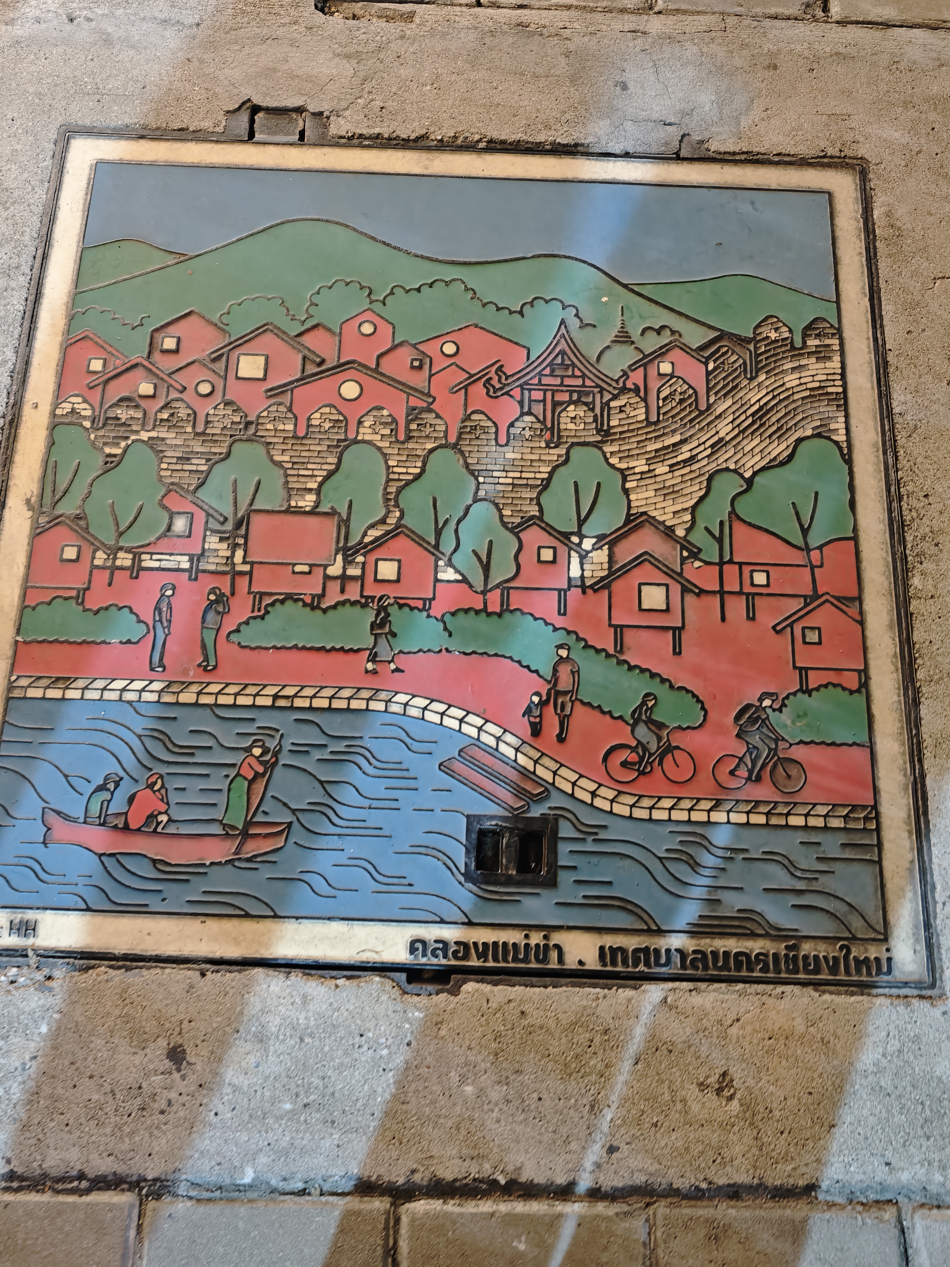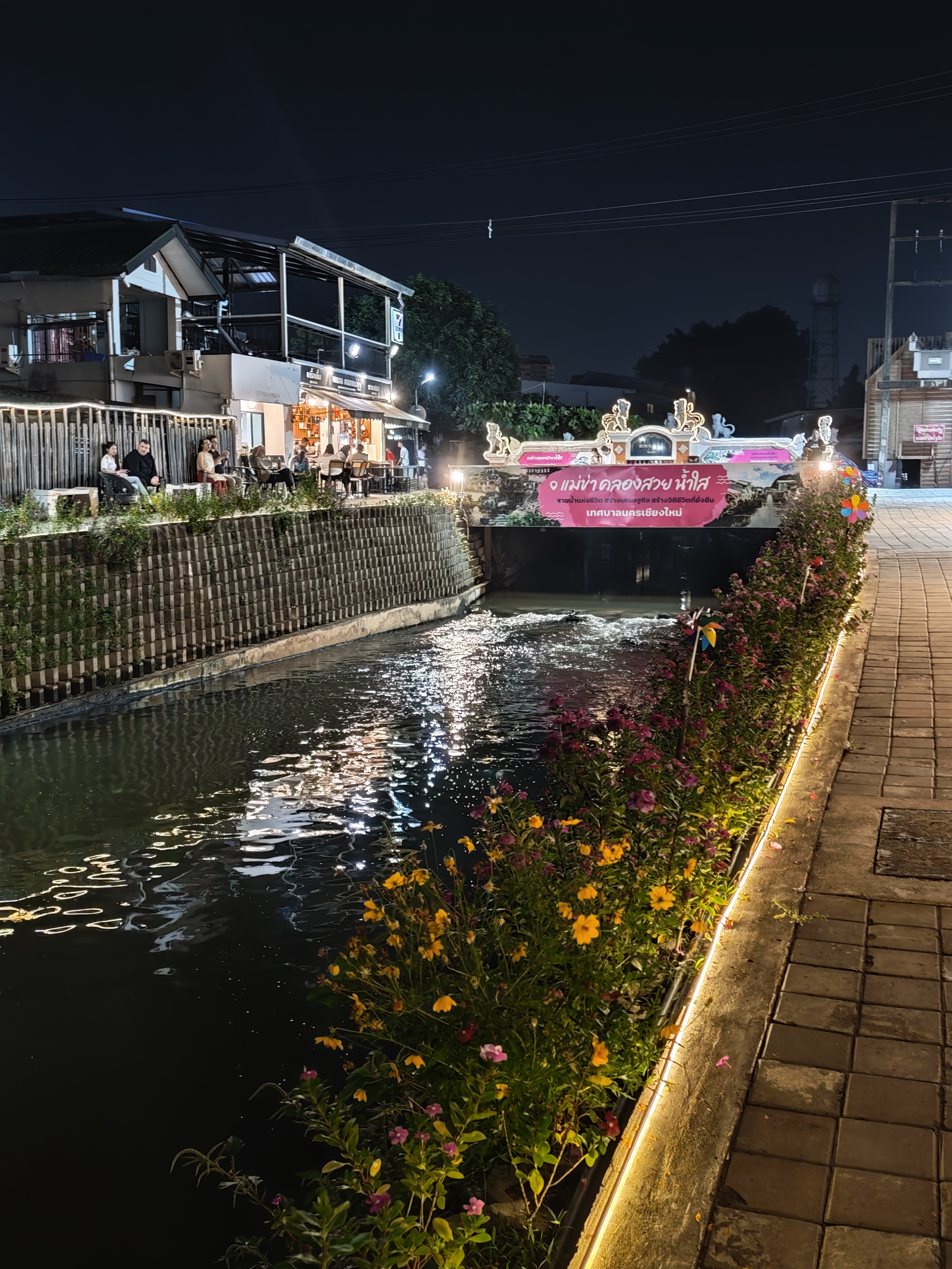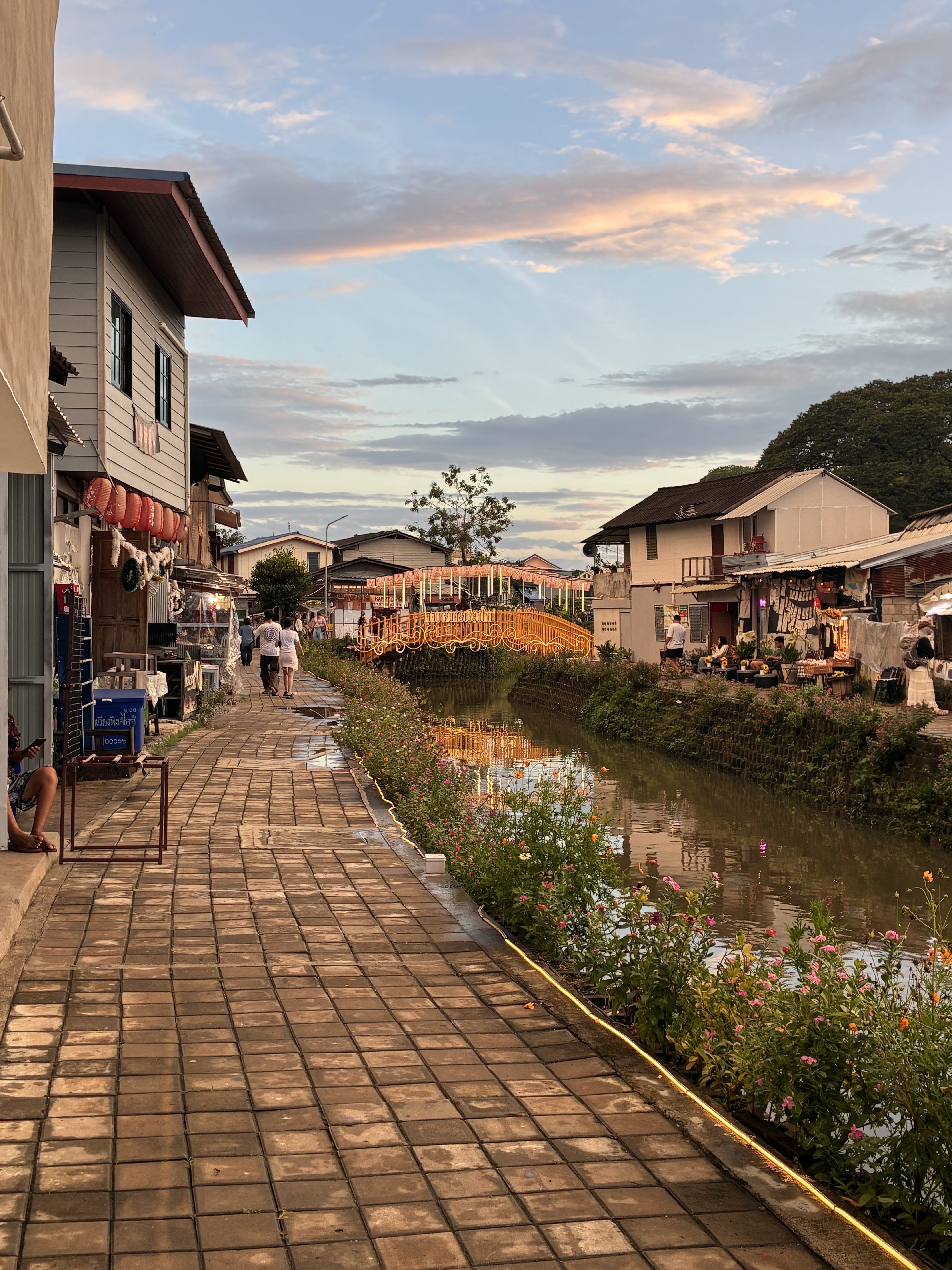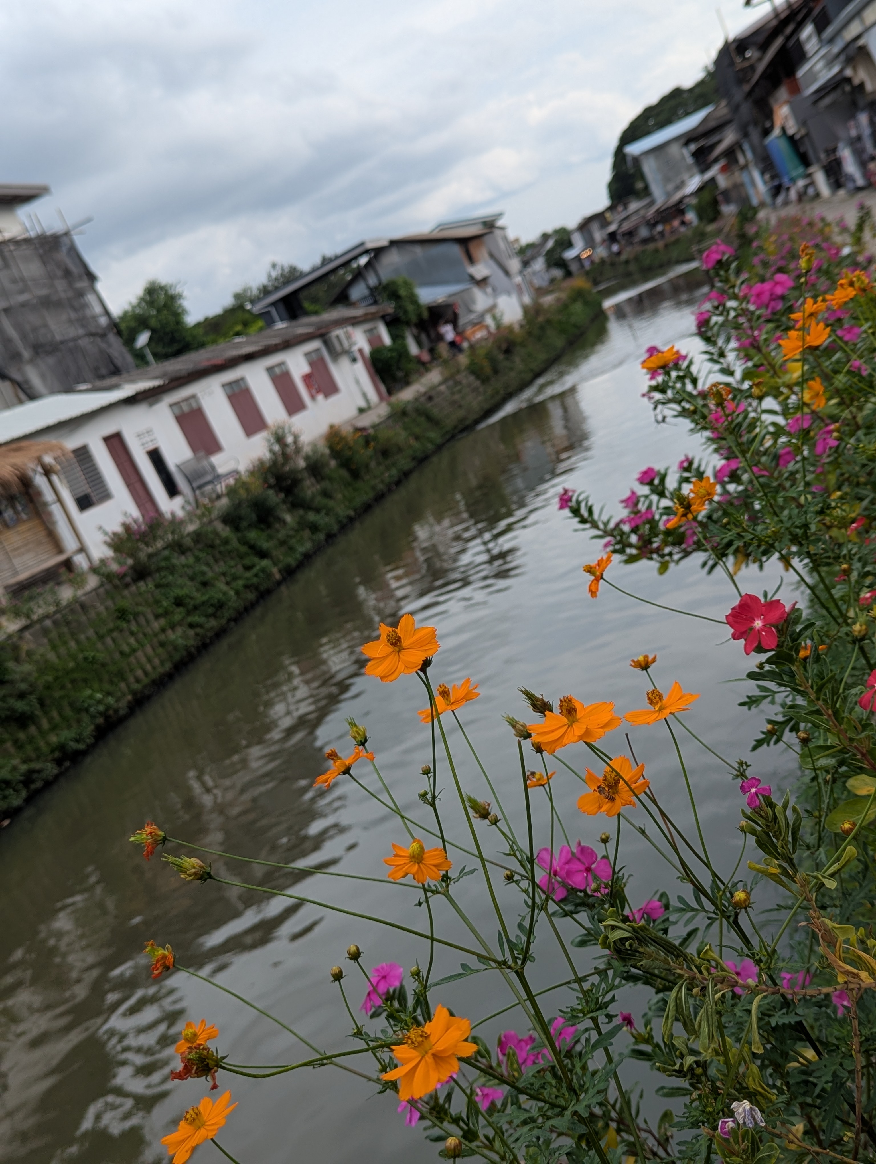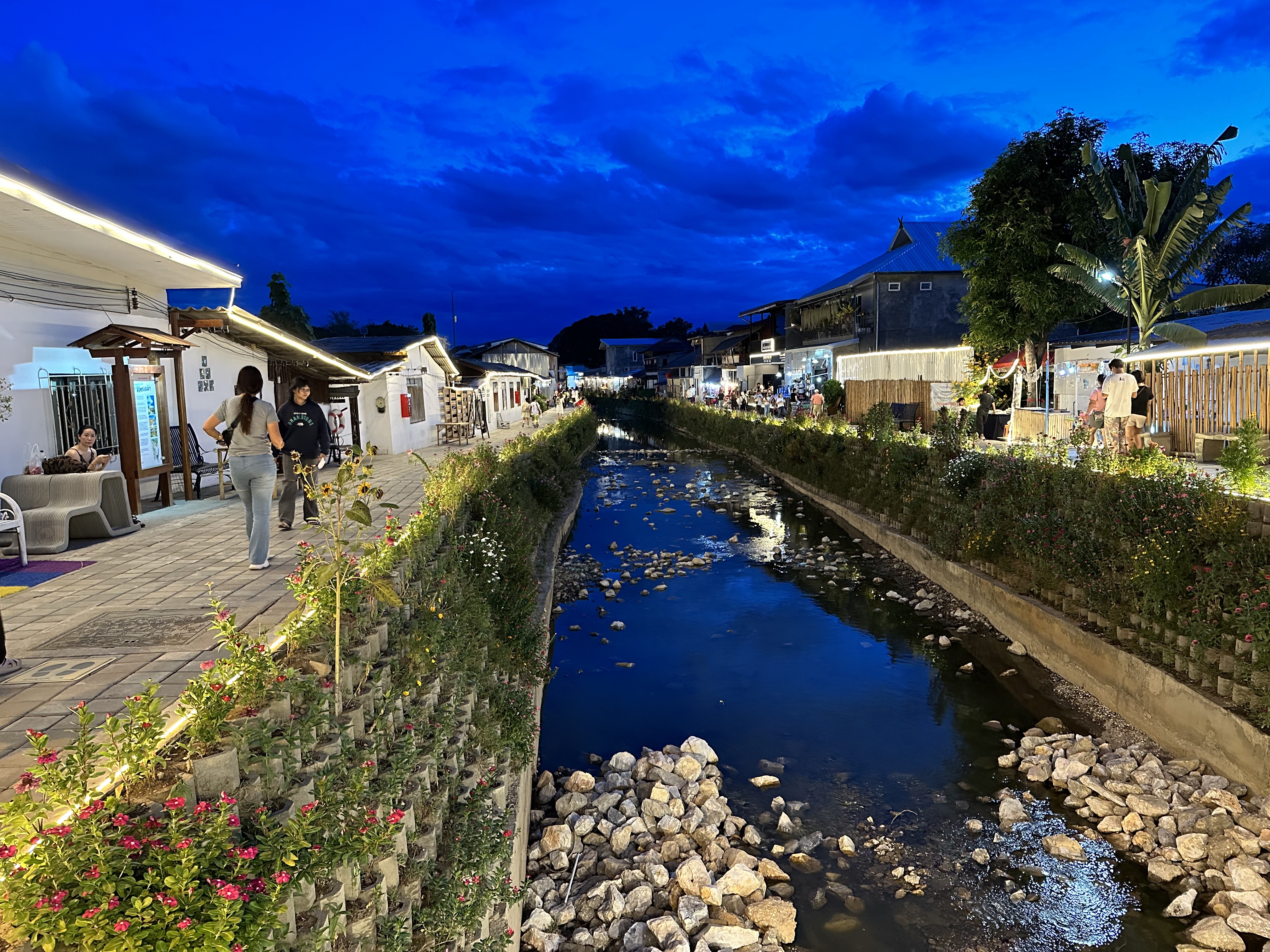
Mae Kha Canal
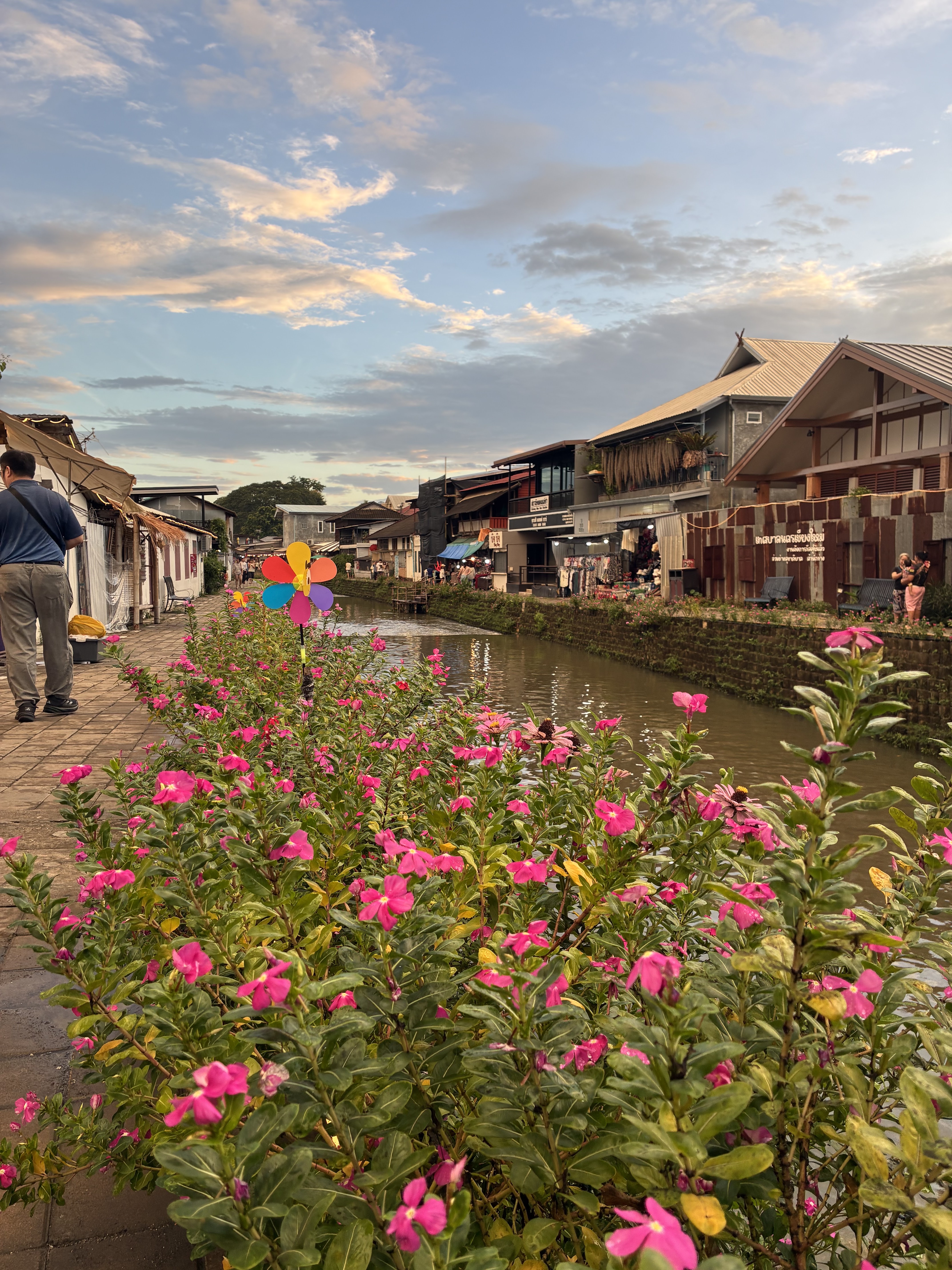
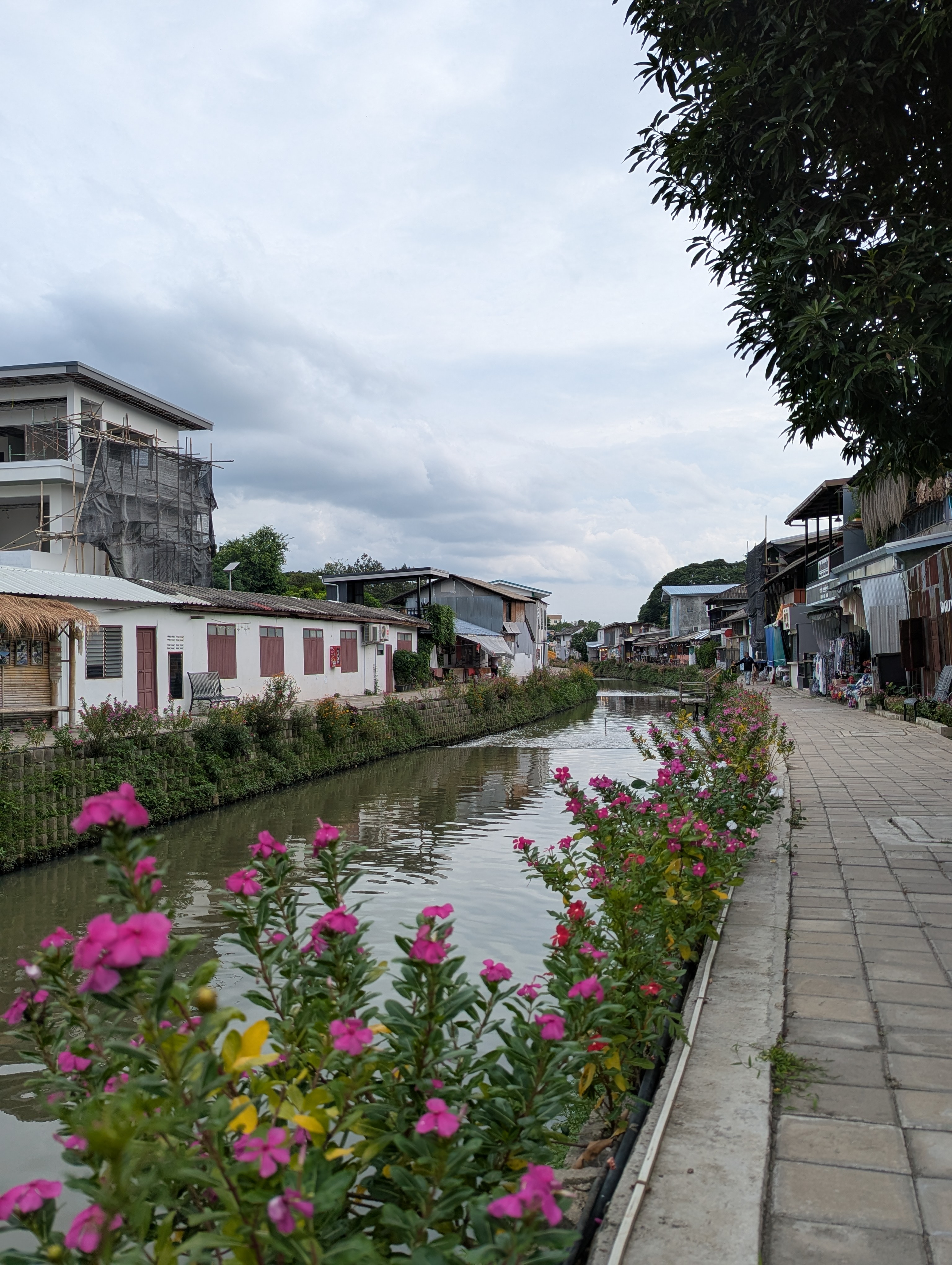
Mae Kha Canal — Main view in Chiang Mai, Thailand

Chiang Mai · Lanna Historic Canal Revival

Mae Kha Canal

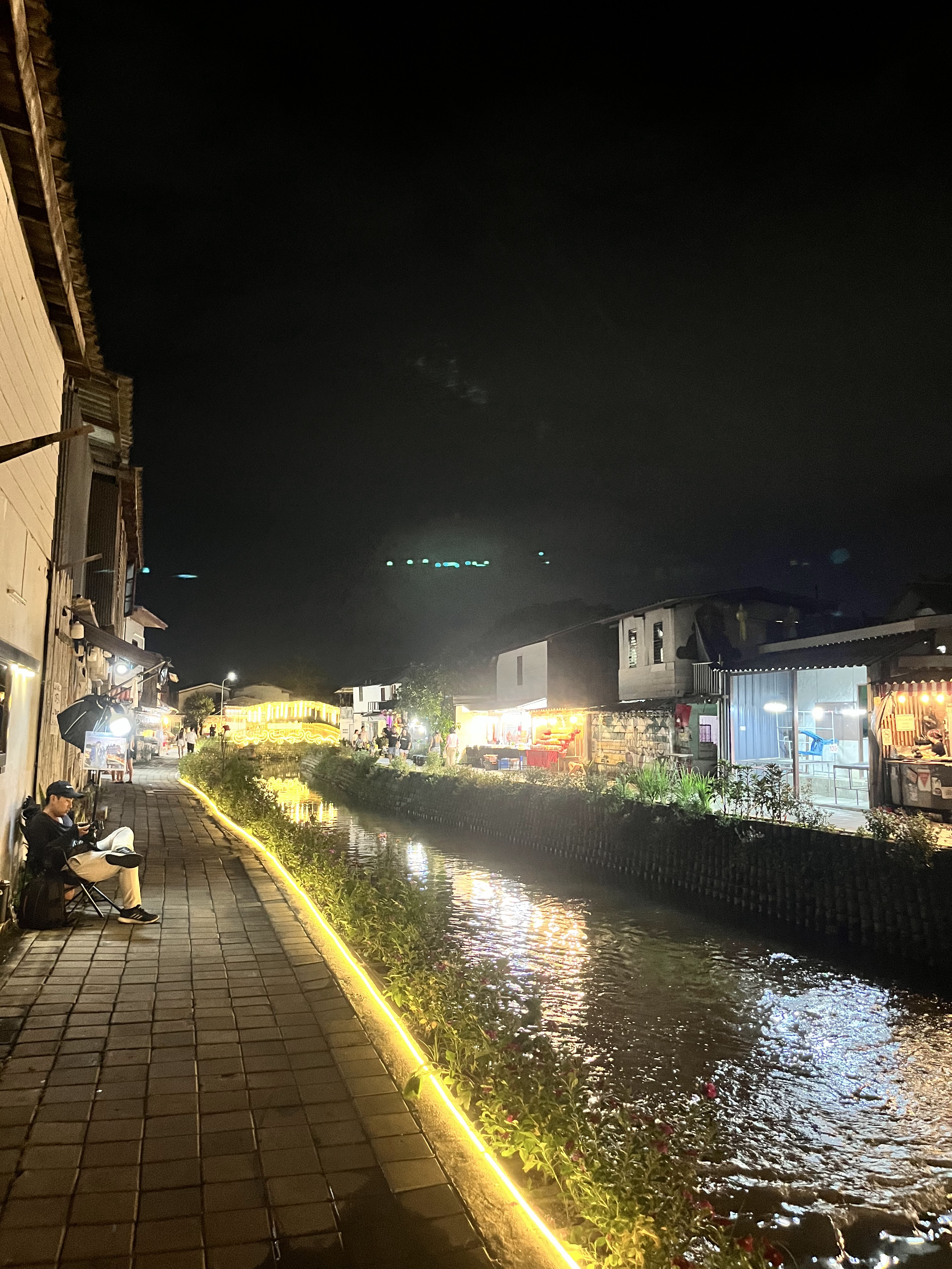
A restored Lanna [ล้านนา] era canal, now a flagship community project of Chiang Mai's urban waterway revival — featuring evening promenades, local boat rides, and riverside market spaces.

★ 4.2 6,216 reviews 18.7771°N, 98.3858°E · Haiya Sub-district, Chiang Mai
View location on Google Maps ↗

Chiang Mai Attraction

Mae Kha Canal

Mae Kha Canal · คลองแม่ข่า

Live Sky & Weather Live
Drizzle
UV Index Very high · Humidity Very humid
25°
🌡️ 29° / 23°
💨 1 km/h 💧 100%
✅ What to wear
  • Humid & sticky — wear quick-dry breathable clothes, drink often
  • Light drizzle — wet wooden boardwalks, mind your step
  • Strong UV — cover exposed skin and use sunscreen
✅ Plan your day
  • Switch indoors — Old City temples or Warorot market stalls; return after the rain
🎒 What to carry

Sunscreen SPF50+ · Sunglasses · Sun hat · Compact brolly · Non-slip / waterproof shoes

No active alerts

Golden & Blue Hour

Times are estimates for the canal's location; actual conditions may vary slightly with terrain.

Morning golden hour06:12 – 07:42
Sunset18:23
Blue hour18:43 – 19:13
Crowd adviceQuieter on weekday mornings

7-day forecast

Today
29°
23°
💧 100%
Tomorrow
29°
23°
💧 99%
Wed
29°
23°
💧 94%
Thu
30°
23°
💧 60%
Fri
31°
23°
💧 49%
Sat
30°
23°
💧 41%
Sun
30°
23°
💧 47%

About the canal

Where old Chiang Mai meets the water

Mae Kha Canal [คลองแม่ข่า] is one of Chiang Mai's historic waterways — once a vital irrigation and transport artery for the Lanna kingdom, today a living riverside community. Geographic attribution: Mae Kha Canal → Haiya Sub-district → Mueang Chiang Mai → Chiang Mai Province → Thailand.

For centuries the canal carried water from the western hills through the city, lining its banks with wooden houses, gardens, and small communities. As Chiang Mai expanded, the waterway was neglected and polluted, and for a time it became little more than a forgotten ditch.

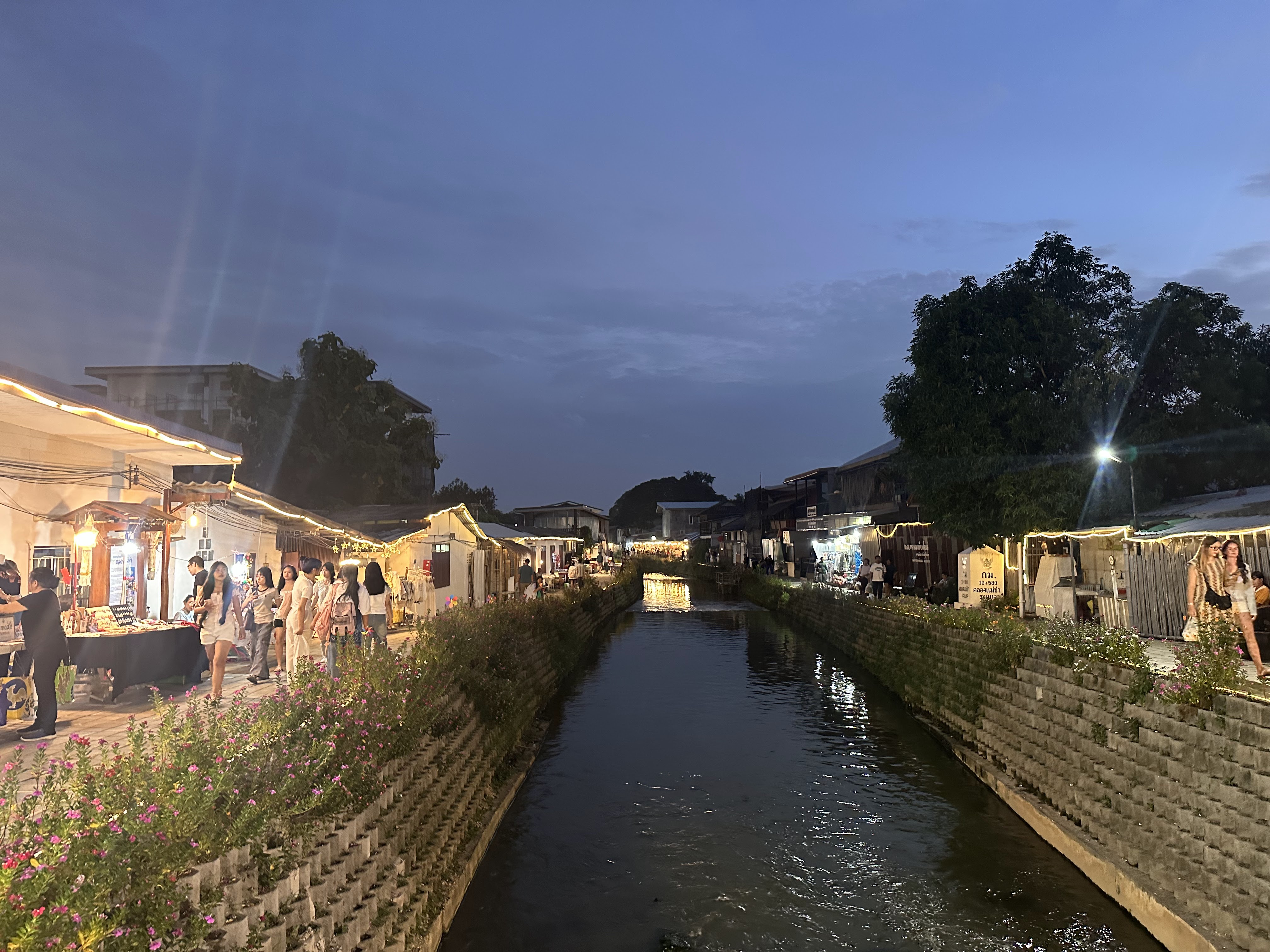
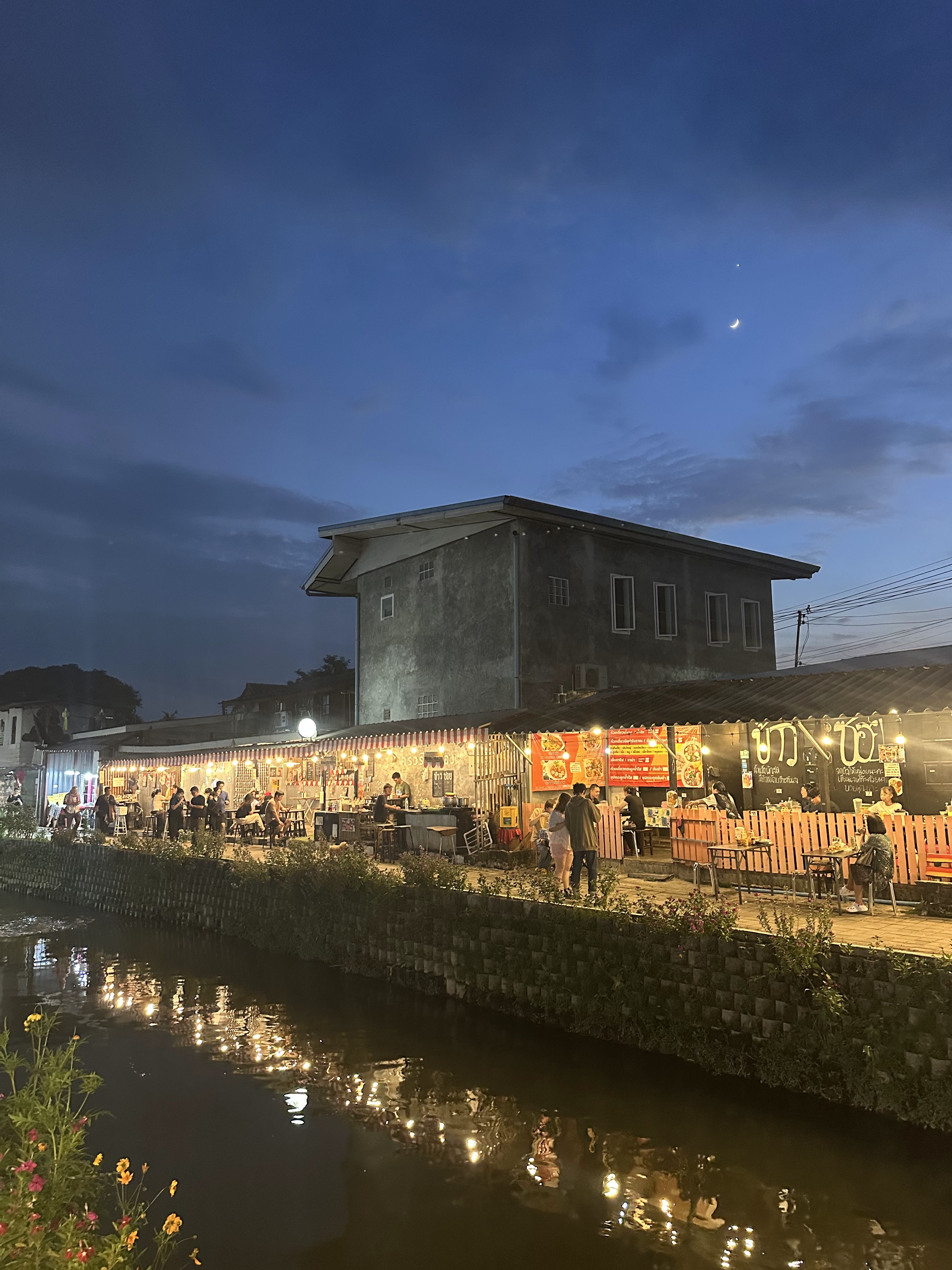
In recent decades local residents and the city have worked together to dredge and revive Mae Kha Canal. Today it is best known for its calm evening walking street, short boat rides, and a string of food stalls and cafés that turn the banks into an open-air kitchen after sunset. Visitors can easily connect with nearby heritage landmarks including Chiang Mai Old City and Warorot Market.

“Walk slowly; the canal remembers more than the city does.”
— A Haiya local resident
700+
Years of hydraulic history
18.777°N
Geographic coordinates
Open all year
Free public space
🚤
Evening boat rides
Quiet long-tail or reed boats drift past old teak houses.
🍜
Canal-side street food
Grilled river fish, boat noodles, and northern snacks.
🎨
Old town & street art
Murals and century-old shophouses along the water.
Editor tip

Arrive around 17:00 to watch the light turn gold on the water, then stay for the evening market.

See the full guide →

Canal ecology

Life returns to the water

“A clean canal is a shared responsibility — between the city, the community, and the river.”

Cleaning Mae Kha brought back more than clear water: lotus, birds, and small fish are returning to the heart of the city.

Microclimate & water

Cooler evenings

The water lowers the air temperature along the banks.

Lotus & reeds

Floating plants filter the water and shelter small fish.

Seasonal flow

Levels rise in the rains (May–Oct) and shrink in the dry season.

Plants along the canal

Lotus (บัว)

Sacred in Thai Buddhism, blooming at dawn along calm stretches.

  • Pink lotus — Common in the quieter southern reaches.
  • Water lily — Opens mid-morning, closes by late afternoon.
Reed & grass beds

Stabilises the banks, with root systems forming a natural phytoremediation filter bed.

  • Cattail [ธูปฤาษี] — Tall reeds swaying at dusk, which effectively absorb excess nitrogen and phosphorus from the water column.
  • River grass — Thin grasses favoured by songbirds.

Wildlife you may spot

  • Kingfishers diving for small fish
  • Water hens skimming the surface
  • Dragonflies hovering over the reeds
  • Herons at the calm bends
  • Small turtles near the banks

Leave No Trace (LNT)

Help keep the canal clean for the next visitor and for the community that lives here.

Tick each as you go — small habits protect a 700-year-old waterway.

Seasonal nature watch

What to look for through the year.

Lotus bloom

🗓 Year-round, best at dawn

Common in calm water

Kingfisher

🗓 Dry-season mornings

Fairly common

Dragonfly hatch

🗓 After rain, May–Oct

Abundant in wet season

History & folklore

From Lanna waterway to evening promenade

The canal's story mirrors Chiang Mai's own — built for water, forgotten, then rediscovered.

Circa 1296 (~700 years ago)

Outer-city defence & natural drainage

Dug as the second defensive moat and natural flood channel outside Chiang Mai's old city. Personally planned by King Mengrai [พญามังราย], establishing its core role in Lanna hydraulic urbanism. Its alignment complements the square old-city moat, forming a characteristic Lanna dual-ring water system.

Mid-20th century

Canalisation & ecological decline

With modern urban expansion, the waterway was neglected and gradually turned into an urban sewer and culverted ditch, devastating its aquatic ecosystem. For a period the surface was covered by refuse, duckweed and eutrophic algae; riverside households effectively turned their backs to the canal.

2017 to Present (ongoing)

Community-led revival: Clear Water Return

Residents, NGOs and the municipality jointly launched the 'Clear Water Return' initiative, reshaping the riverside public space through dredging, sewage interception and ecological filtration. As of 2026 the project is still advancing section by section, and is a widely cited case study in small and medium-sized Southeast Asian urban waterway regeneration.

如今(清水与复兴)
过去(暗渠与衰败)
过去(暗渠与衰败)
如今(清水与复兴)

向左右拖拽滑块,查看运河整治前后的对比

Why 'Mae Kha'? — Toponymic note

In northern Thai dialects, 'Mae [แม่]' means mother or river, and 'Kha [ข่า]' means Galangal. The canal's banks may once have been covered in wild galangal, reflecting the natural vegetation cover of the pre-modern Lanna basin. The name belongs to a widespread 'river + plant' toponymic pattern found across the basin.

Hydraulic history fact

Chiang Mai's old city is enclosed by a square moat; Mae Kha Canal was one of the outer canals that drained and irrigated the wider plain. Multiple branch canals, now filled in, once ran between them — their traces can still be read in the street grid south of the old city.

Water spirits & folk ecology

In pre-modern society, offerings to the water spirit [Phi Mae Nam / ผีแม่น้ำ] were not merely beliefs but a de-facto ecological protection mechanism (Ecological Taboo). Out of reverence for the spirits, residents strictly prohibited dumping waste into the river — effectively preserving water quality in an age without modern treatment plants. Shortly before Songkran each year, Haiya's older residents still hold small riverside purification ceremonies.

A note on respect

If you see a small spirit house or flower offering by the water, admire it from a distance and do not touch or disturb. If taking photographs near private homes, a nod to the residents is polite; avoid using private courtyards as foregrounds for commercial imagery.

Visit guide

Everything you need to visit

Practical, honest advice for a relaxed evening at Mae Kha Canal.

Two ways to enjoy it

Choose your pace — a slow wander or a boat ride.

Walk the banks
Easy

Pace:Easy· Flat paved paths, accessibility-friendly

Best for: Families, photographers, low-mobility visitors

Stroll the promenade, browse food stalls, and watch the sunset on the water.

Boat ride
Easy

Pace:Easy· Short loops ~20–30 min

Best for: Couples, first-timers, photographers

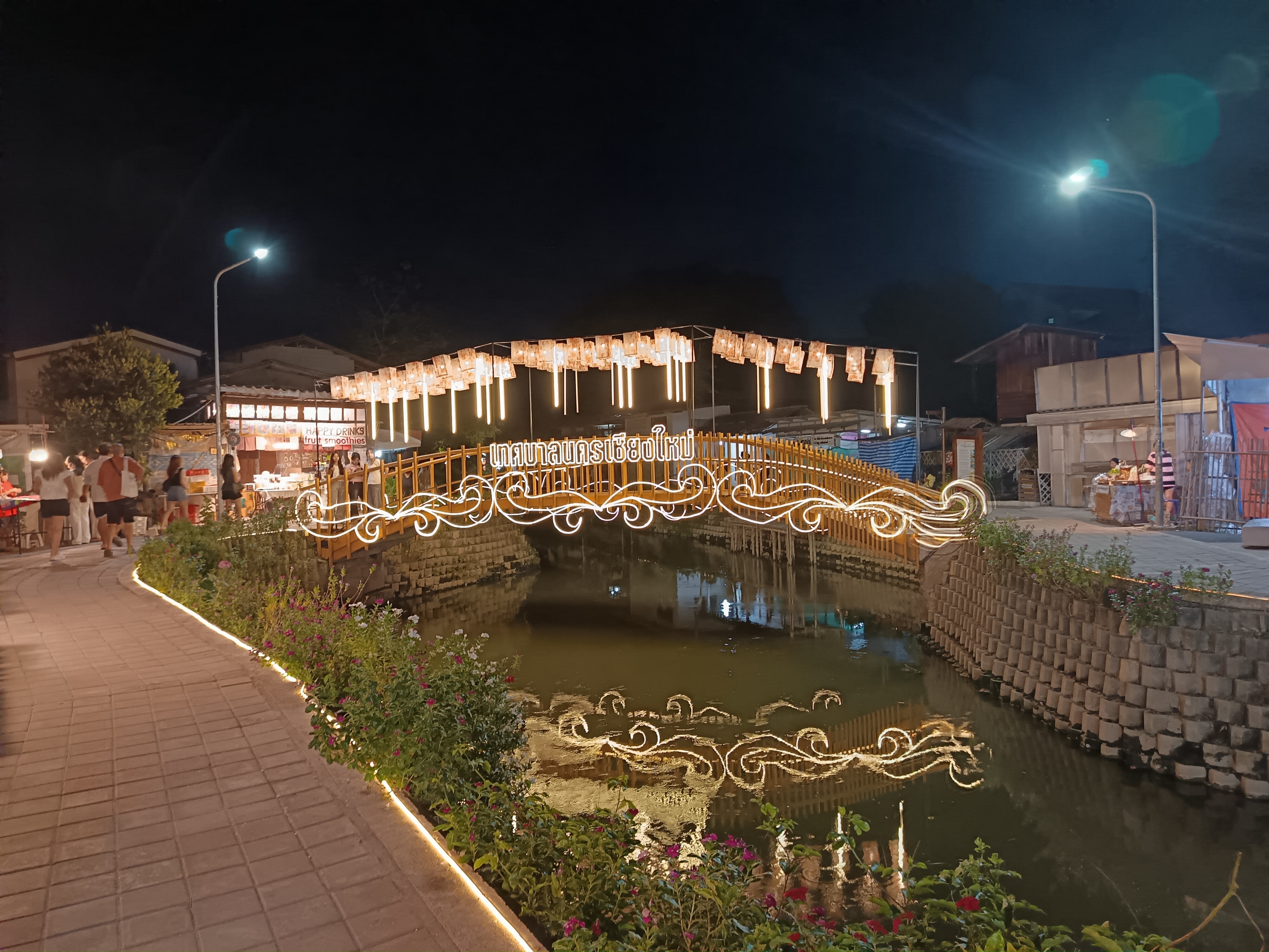
Hop on a small boat for a calm loop past teak houses and lit bridges.

⚠️ Honest Expectations

Mae Kha Canal is essentially still a mixed urban drainage and flood channel. Despite extensive dredging, mild odours may occur during the dry season (especially March–April) when water levels drop. Please view it as a community revival 'in progress' rather than a pristine natural river.

🕒 When to go

16:00 – 22:00 (Evenings)

  • Opens16:00
  • Best light17:00 – 18:30
  • Liveliest18:00 – 20:30
  • Closes22:00
💸 Cost

What it costs

  • Entry
    Free to walk the canal and market; the public promenade is open year-round.
  • Boat ride
    Small fee per person; pay in cash at the pier.
  • Food & drinks
    Street snacks from a few baht; cafés offer full meals.
🚌 Getting there

How to reach Mae Kha

  • By car / taxi
    Set 'Mae Kha Canal, Haiya' in your map app; roadside parking is limited on weekends after 17:00 — ride-hailing or songthaew recommended.
  • By red songthaew
    Chiang Mai's shared red trucks pass near Haiya; tell the driver your destination.
  • By bicycle
    A flat, short ride from the old city along signed routes.
  • Chiang Mai International Airport [CNX]
    Only about 4 km away (10–15 min by car). Ride-hailing (Grab / Bolt) is available on the ground floor, or use the official Airport Taxi counter and ask for 'Mae Kha Canal, Haiya'.

📊 Quarterly strategy table

Comprehensive quarterly visiting strategy (30-year climatology normal)

Based on the 30-year average climatology published by the Thai Meteorological Department, integrating temperature, rainfall probability, water clarity and wildlife activity levels to provide visiting guidance.

QuarterTemperatureRainfallWater clarityWildlifeRecommendationStrategy
Cool (Nov – Feb) 14–28℃ Virtually no rain Medium water level; clearest visibility of the year Migratory wintering birds; kingfishers & herons active; lotus semi-dormant ★★★★★ Prioritise 17:00–20:00 evenings; combine with nearby Old City temples.
Hot (Mar – Apr) 22–38℃ Occasional convectional showers Low level, some shallows exposed; sensitive visitors may notice mild odour Mass dragonfly hatch; river grass blooms; densest dawn bird chorus ★★★ Only visit around sunset (16:30–19:30); carry water; avoid agricultural burning peaks (Feb–Mar).
Early wet (May – Jul) 24–34℃ 60%+ chance of afternoon showers Water level rises fast; higher turbidity Peak fish breeding; fledglings leave nests; river grass grows fastest ★★★★ Carry a foldable umbrella and waterproof shoes; boats may pause in heavy rain; mornings or post-showers recommended.
Late wet (Aug – Oct) 23–32℃ Prolonged rain; elevated extreme-weather risk Highest water level; best natural purification efficiency Lotus re-enters full bloom; herons congregate at calm bends ★★★★ Pair with indoor itineraries (museums / cafés); evenings still offer quality shooting light.

🧭 Audience-tailored itineraries

Three targeted routes (choose one)

Select the flow that best matches your travel composition and pace. No specific vendors are recommended; only types and geography are described.

👨‍👩‍👧 Family-friendly (Very low pace · ~2.5 h)

节奏:Pace: very slow
适用:Ideal with children aged 4–12
  1. 30 Enter from the main Haiya entrance; head south along the flat southern promenade (barrier-friendly).
  2. 50 Pause at the lotus viewing section for 10–15 min (railed safety zones); guide children to observe small fish and dragonflies.
  3. 10 Reach the central public rest area; have dinner at street-food-type outlets (including dessert-style stalls for children).
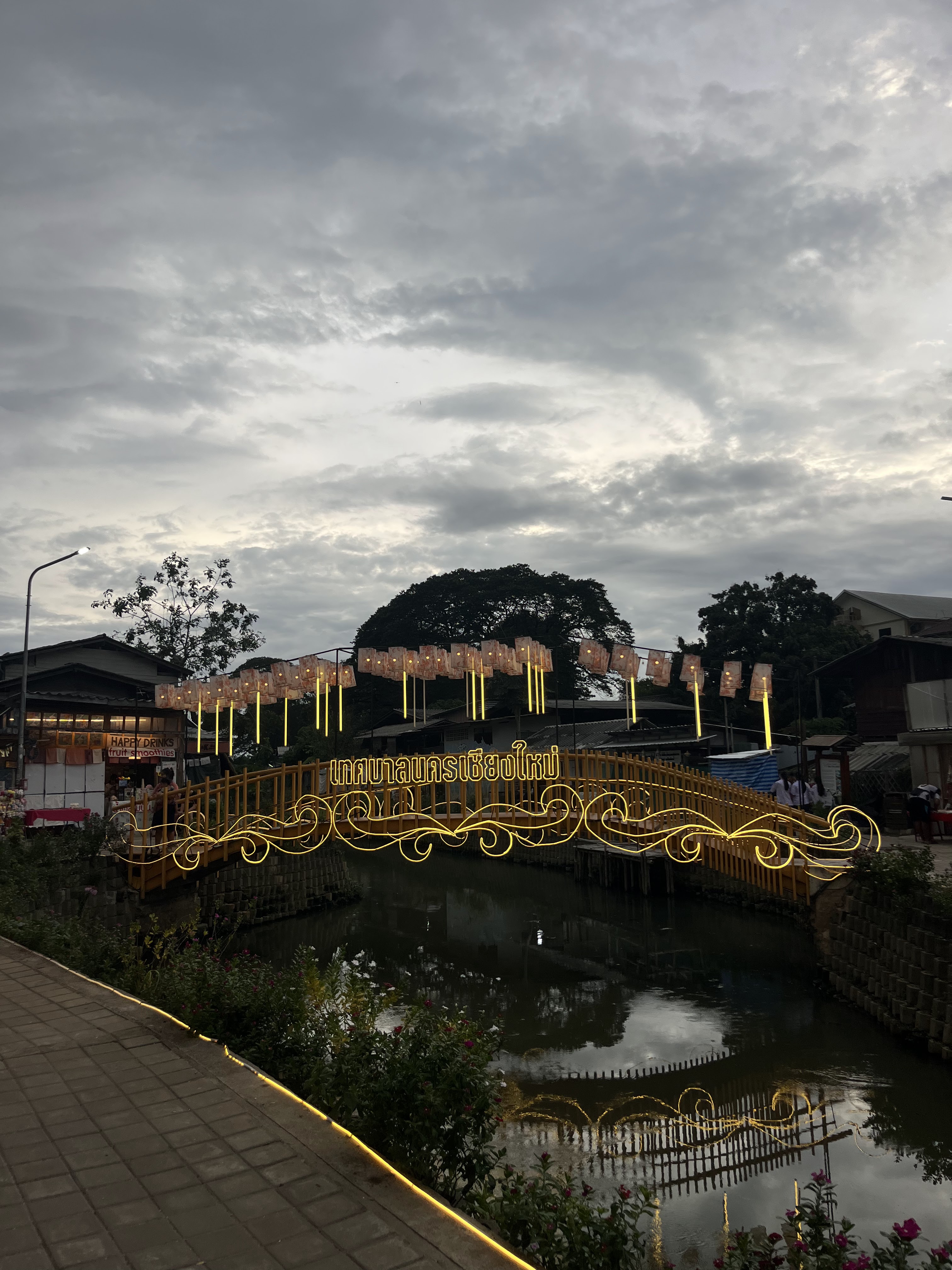
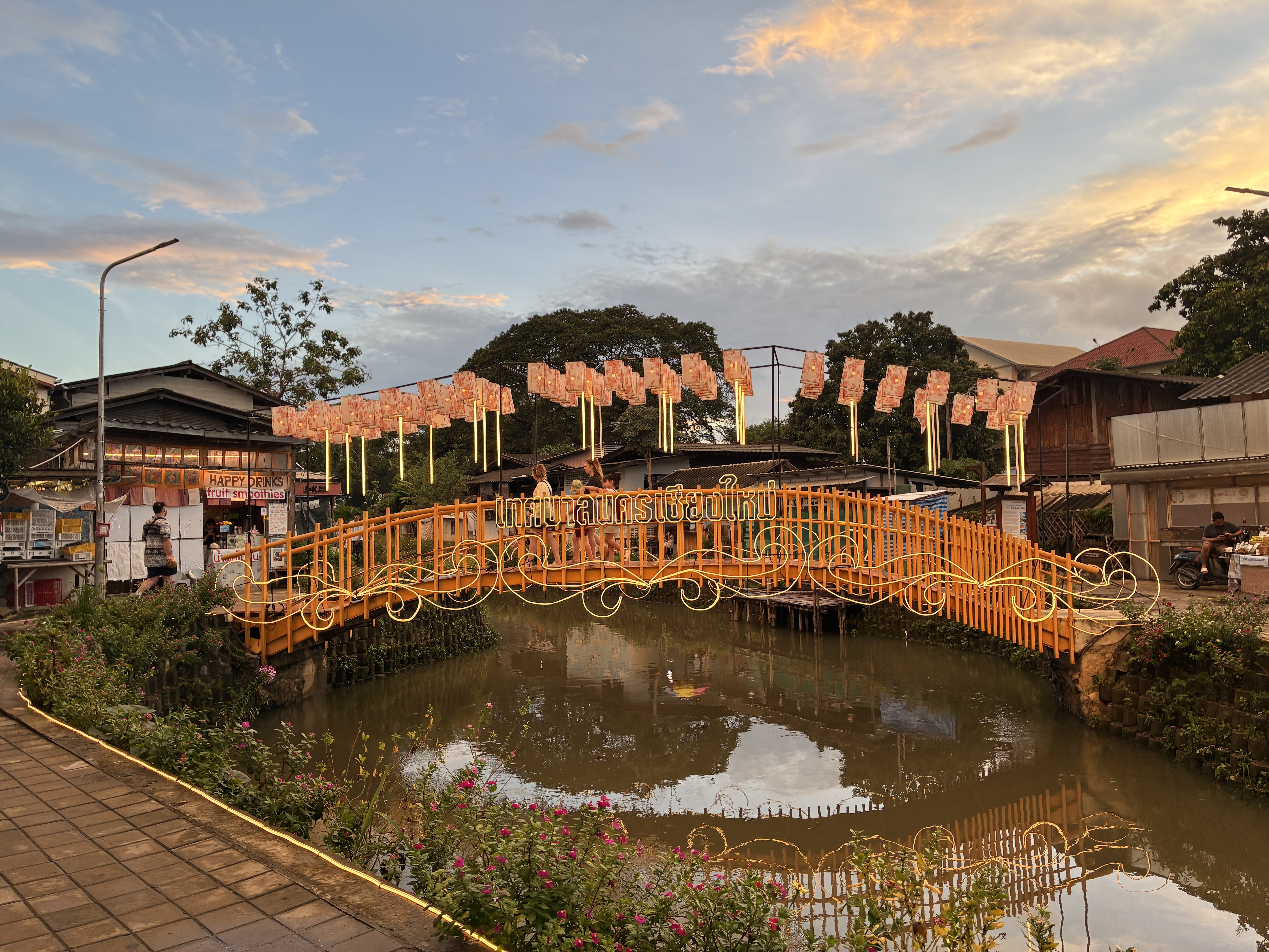
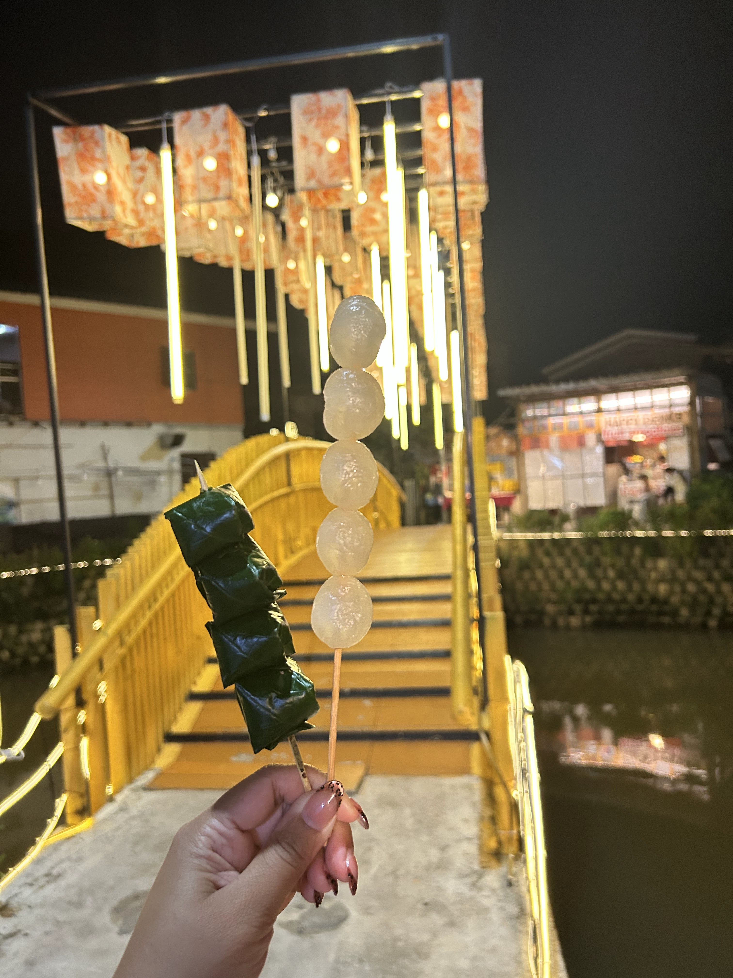
  4. 10 Amble slowly to the lit wooden bridge for photos and watch the sunset gild the water.
  5. 45 Brief stop at the rest area then depart; overall avoids peak crowd windows.

💡 Recommended: wet wipes, repellent, a spare change of clothes.
📷 Photography & nature (Medium pace · ~4 h)

节奏:Pace: moderate
适用:DSLR/mirrorless users & naturalists
  1. 00 Enter from the north section with a tripod; first set up near the old teak bridge.
  2. 30 Shoot lotus, reeds, dragonfly close-ups (low angle + polariser).
  3. 00 Walk to the lit footbridge for foreground architecture + water reflections (golden hour).
  4. 30 Move to the market lantern zone for warm-toned candid shots (respect the subjects).
  5. 00 Return to the bridge position before blue hour for long-exposure night illuminations.
  6. 40 Retire to a café-type venue to review shots and wait for crowds to thin.

💡 Telephoto (200mm+) can capture kingfishers at dawn; 16–35mm suits wide reflections.

♿ Low-mobility / accessible (Very light · ~1.5 h)

节奏:Pace: very slow
适用:Wheelchair, elderly walkers, stroller users
  1. 30 Enter the main promenade via the accessibility ramp (consult official signage or information point).
  2. 40 Sit down in a public bench-type area to rest and observe the water.
  3. 00 Proceed ~400 m along the main barrier-free path, passing dining and public-WC-type nodes.
  4. 40 Return the same way after reaching the photo spot; a companion may independently take a boat ride if desired.
  5. 00 Take a taxi / ride-hail from near the entrance.

💡 Weekdays or off-peak evenings recommended; shaded colonnades available in some sections.

🗺 General itineraries

Recommended half-day / full-day routes (no specific vendors)

Half-day (~3 h · evening)

  1. 30 Arrive at the entrance; walk south along the gentle southern promenade.
  2. 00 Reach the lotus section for viewing and photos; stay 15–20 min.
  3. 20 Continue past the public rest area and dining-type nodes.
  4. 00 Arrive at the lit bridge; await sunset and blue hour.
  5. 00 Have dinner or dessert at dining-area-type stalls.
  6. 30 Browse market-type public spaces; leave from the main entrance around 20:00.

Full-day (~6–8 h · connecting heritage landmarks)

  1. 30 First visit Chiang-Mai-Old-City-type heritage landmarks (temples, moat).
  2. 30 Lunch at dining-area-type venues between the Old City and Haiya.
  3. 00 Wander through Warorot-Market-type riverside market spaces (walk or ~10 min drive).
  4. 00 Arrive at Mae Kha Canal's southern entrance; continue with the 'half-day' flow.
  5. After 20:30, if still energetic, visit a Nimman-road-type café district.

🚻 Visitor services & nearby facilities (neutral overview)

Visitor services & nearby facilities overview

Only facility types are described; no specific vendor or brand names are recommended to maintain objectivity.

Public toilets (WC)

Public-toilet-type nodes are available near the middle of the main promenade and near the evening market entrance; some are coin-operated (small fee), others are free. Most are lit after dark and include sinks. Bring your own tissue paper.

· Accessible-toilet-type facilities are mainly at the main entrance and dining clusters.

Parking facilities

On-street parking bays and small-parking-lot-type spaces are distributed in surrounding blocks. On weekends and holidays after 17:00 bays are tight — ride-hailing, songthaew or cycling are preferred. Drivers should arrive before 16:00 to find a spot.

· Motorcycle / bicycle type parking is common, mostly roadside lined zones.

Dining types (neutral)

The evening market hosts street-food-stall-type outlets and small-restaurant-type venues, covering northern-style noodles, rice meals, grilled fish, desserts, drinks and coffee-type offerings across a wide price range to suit different budgets.

· Most stalls only open fully after 17:30; observe food hygiene and follow where local residents eat.

Lodging types (neutral)

Haiya district and the Old City's southern gate area offer small-guesthouse-type, family-homestay-type, budget-hotel-type and mid-to-upscale-hotel-type accommodation. Walking distance to the canal ranges from 5–15 min to a 10–15 min taxi ride.

· Prioritise cancellation policy, accessibility features and noise reviews (weekend market areas can be loud).

Supermarket & convenience store types

Within a 500 m radius of the main entrance there are chain-convenience-store-type and small-to-medium-supermarket-type nodes. Stock up on drinking water, sunblock, repellent, power banks, snacks and tissue.

· Most convenience-store-type venues are open 24 h for last-minute supplies.

Fuel & charging types

Self-driving visitors can find petrol-station-type outlets along main roads (Ragang Rd and adjacent arterials); EV-charging-point-type facilities are available near some convenience stores and parking lots. EV owners should map the nearest available station before departure.

· Charging-point-type coverage in Chiang Mai is improving but high-speed DC options remain limited — top up daily.

Medical & pharmacy types

Haiya's surroundings include community-pharmacy-type and general-hospital-type institutions. Common OTC medications (analgesics, antidiarrhoeals, plasters, repellent) are available at pharmacy-type outlets; in case of emergency dial 1669 (ambulance) or 191 (general emergency).

· Carry an English or Thai allergy card if you react to specific drug ingredients.

🔬 Science & visitor responsibility

Science & visitor responsibility (E-E-A-T section)

Hydraulic and ecological restoration — scientific background

  • [01](1) Ecological riverbeds & phytoremediation beds: Mae Kha Canal's remediation borrows from phytoremediation principles — cattails, reeds and lotus are planted on banks, whose rhizosphere microbes degrade organics and adsorb nitrogen/phosphorus, avoiding large-scale concrete hardening that would destroy hydrology.
  • [02](2) Tropical urban heat-island mitigation: every square metre of water surface can reduce near-ground temperature by roughly 2–4℃ at midday, turning the riverside into Haiya's 'urban cool alley' — which explains why old neighbourhoods feel notably cooler in the hot season.
  • [03](3) Water-quality evolution & seasonal risk: wet season brings large volume and high self-purification but high turbidity; dry season brings low, clear water but elevated eutrophication risk. Mild odours perceived in the dry season are a universal trait of urban waterways and should be rationally expected.
  • [04](4) Biodiversity value: post-remediation returns of kingfishers, water hens, herons, dragonflies, terrapins and small fishes indicate water metrics falling within Thailand's Ministry of Natural Resources 2023 public landscape water Class I–II band.

Visitor responsibility & community code

  • ✅ All packaging and food waste must be carried out or placed in designated bins; never throw anything into the water as it may clog channels.
  • ✅ Do not feed wildlife (fish, birds, turtles) — unnatural diets create dependency and population imbalances.
  • ✅ Keep conversation and music volumes down after dark to avoid disturbing the daily routines of riverside residents.
  • ✅ Respect the private space of riverside homes; do not use yards as photographic foregrounds or enter without permission.
  • ✅ Always wear life jackets during boat rides; in the event of high water or lightning, obey the boat operator's instructions to shore promptly.
  • ✅ If you encounter a community ritual (water offerings, small alms rounds), observe from a distance — do not touch, photograph or comment.

About Community-Based Tourism (CBT)

Mae Kha Canal's revival is fundamentally a community-led CBT experiment: shoreline maintenance, part of the cleaning and stall management are run by Haiya resident volunteer groups. As a non-profit science platform this page provides only neutral information and does not derive commission or referral fees from any vendor. If you wish to give back to the community, please patronise small stalls run by local residents and respect their unwritten norms (e.g. do not linger long at entrances; be patient while queuing).

Photography guide

The canal is at its best in soft evening light.

Best light

Golden hour

~17:00–18:30 — warm light on the water and teak houses.

Blue hour

~19:00–19:40 — lit bridges and reflections.

Early morning

06:00–07:30 — mist and locals at the water's edge.

Photo spots

Old teak bridge

Reflections of heritage houses

Use a low angle near the water.

Lotus stretch

Pink lotus at dawn

Arrive before 08:00 for open blooms.

Market lanterns

Warm string lights at dusk

A small tripod helps in low light.

Camera settings

Golden hour

f/8, ISO 200, 1/250s

Tap to expose for the sky, HDR on

Blue hour

f/5.6, ISO 400, 1/60s

Night mode, steady for 2–3s

Reflections

Polariser, low tripod

Get close to the water's edge

Quick tips

  • Arrive 30 minutes before sunset
  • Shoot towards the lit bridges
  • Keep a cloth for lens mist
  • Respect residents' privacy — nod before shooting homes

Best time to visit

Chiang Mai has three distinct seasons that change the canal's mood.

❄️ Nov – Feb

Cool season

Pleasant evenings and the clearest light — the most comfortable time to walk.

🔥 Mar – Apr

Hot season

Warm nights; go early in the opening hours to avoid heat. Note agricultural burning haze Feb–Mar.

🌧️ May – Oct

Rainy season

Lush banks and fewer crowds, but afternoon showers may pause boat rides.

Stay safe

  • Near water — Supervise children closely; some banks are unrailed.
  • Boat rides — Wear the life jacket provided and follow the operator's instructions.
  • Belongings — Keep bags zipped in busy market areas.

🌫️ Burning-season (haze) advisory

Roughly late February to early April, open burning in northern Thailand hills and cross-boundary transport may elevate PM2.5. Sensitive travellers (asthma, children, the elderly) may prefer December–January for cool, clear air, or check local AQI readings daily before setting out.

Emergency contacts

For urgent help in Thailand:

Accessible for everyone

The canal promenade is largely flat and step-free.

  • Wheelchair & stroller — Paved paths along most of the promenade; main entrance has an accessibility ramp.
  • Rest areas — Shaded benches and cafés with seating.
  • Toilets — Public facilities near the market area; includes accessible-type cubicles.

Frequently asked questions

Where is Mae Kha Canal? Which district of Chiang Mai? +

Mae Kha Canal (คลองแม่ข่า / Khlong Mae Kha) is located in Haiya Sub-district, Mueang Chiang Mai District, Chiang Mai 50100, Thailand. The specific address is 118 Ragang Rd, Haiya; approximate coordinates are 18.7771°N, 98.9836°E.

Is Mae Kha Canal free? Do I need a ticket? +

Yes. Mae Kha Canal is a free public space (isAccessibleForFree). Walking the promenade and browsing the market require no ticket. Boat rides and food are paid separately.

When does it open? What is the best time to visit? +

Evenings 16:00–22:00 are the liveliest windows (stalls and boats operate). Best light is 17:00–19:30 (golden + blue hour). Weekday mornings are the quietest if you prefer solitude.

How do I get there from the Old City / Airport / Night Bazaar? +

From the Old City: red songthaew shared taxi, Grab/Bolt ride-hailing or a short flat bicycle ride (10–15 min). From Chiang Mai International Airport (CNX): ~4 km / 10–15 min drive — use Grab/Bolt or the official Airport Taxi counter. From the Night Bazaar / Chang Klan: 5–8 min walk or cycle along the eastern riverbank. Map keyword: Mae Kha Canal, Haiya / คลองแม่ข่า เชียงใหม่.

Is parking available nearby? How easy is it to find a spot? +

Both canal banks offer municipal public parking zones and adjacent commercial-space parking types. Spots fill fast on weekend evenings; arriving by songthaew, ride-hailing or bicycle is recommended to avoid circling narrow Haiya lanes.

How long should I spend? What does a half-day itinerary look like? +

Allow 1–1.5 hours for the core promenade + food; 2 hours if you add a boat ride. Recommended half-day order: Old City temple circuit (morning) → Warorot Market food run (lunch) → Mae Kha Canal sunset boat + riverside dinner (17:00–20:30).

Are the boat rides worth it? +

Highly worth it for first-timers — a short 20–30 minutes reveals old teak houses and lit bridges unseen from the promenade. Board 30 minutes before sunset.

Is it suitable for families / low-mobility / wheelchair visitors? +

Very suitable — flat promenade, wide food variety, accessibility ramps and rest areas. However, always supervise children near unrailed banks.

Will there be an odour in the dry season (Mar–Apr)? What is the realistic expectation? +

Slight odour may occur as the water level drops; fundamentally this is a mixed urban waterway. Please treat it as a revival 'in progress' rather than a pristine wilderness river; visit around sunset and shorten your stay if sensitive.

What is the historical background? Why is it called 'Mae Kha'? +

The canal dates to King Mengrai's Lanna era (c. 1296) as part of an outer dual-ring irrigation-and-defence system. 'Mae' means mother / river; 'Kha' refers to galangal, recalling wild galangal once prolific along its banks — a classic Lanna 'river + plant' toponym.

Food & drink (type-only · no specific stalls)

Eat by the water: an open-air kitchen of northern flavours

After sunset the riverside market becomes an open-air kitchen of northern Thai cuisine. Below we describe common dish types and their cultural backgrounds; no specific establishment is named.

🍜
Boat Noodles [Kuay Teow Ruea / ก๋วยเตี๋ยวเรือ] ~60–80 ฿

Rich-broth noodles originating from floating markets, thickened with pork or beef blood and spiced — a tasty residual of the canal's waterborne trade history. Traditional portions are small; 2–3 varieties can be sampled in one sitting.

🐟
Salt-Crusted River Fish [Pla Pao / ปลาเผา] ~100 ฿

Freshwater fish coated in thick salt, stuffed with lemongrass and pandan leaves and grilled to lock in moisture while removing earthy undertones. Traditionally paired with green papaya salad and sticky rice.

🌮
Northern Sausage [Sai Ua / ไส้อั่ว] ~30–50 ฿

A fermented pork sausage packed with lemongrass, kaffir lime leaves, galangal and red curry paste — a traditional northern Thai meat preservation technology for the tropics.

🍧
Coconut Pancakes [Khanom Krok / ขนมครก] ~40 ฿

A traditional dessert made from rice flour and coconut milk, griddle-fried in hemispherical moulds to produce a crisp outer shell and a soft, molten coconut core.

🥭
Mango Sticky Rice [Khao Niew Ma Muang] ~60–90 ฿

Thailand's national dessert, pairing fresh ivory mango with coconut sticky rice. Peak mango season in Chiang Mai is April–May.

🍵
Thai teas & iced coffee ~25–50 ฿

Riverside drink types include Thai iced milk tea, butterfly pea lemon tea and northern-style iced coffee; ask to adjust sugar levels.

Eat by the water: an open-air kitchen of northern flavours
“The best meal in Chiang Mai might be the one you eat standing by the canal.”
— A regular visitor

Visitor reviews

What visitors say

A snapshot of recent visitor impressions. Displayed on page only; not embedded in structured data.

★★★★☆ 4.2 · 6,216

Rating and review count synced from Google Maps user reviews · September 2026 · Click to see all Google Maps reviews ↗

Synced from Google Maps user reviews, sync date September 2026; © original authors and Google Maps.

“A peaceful evening walk you won't find in the guidebooks — boats, lights, and good food.”
★ 5.0 · Visitor review snapshot
“The boat ride at sunset was the highlight of our Chiang Mai trip.”
★ 5.0 · Visitor comment snapshot
★★★★★
Food type: Boat noodles

The little boat-noodle-type stall by the bridge was unforgettable.

Anee Mar 2026
★★★★☆
Evening walk

Calm and pretty once the lanterns come on. Go after 18:00.

Tom Feb 2026
★★★★★
Boat ride

Short but lovely — the operator was friendly and pointed out old houses.

Lina Jan 2026
★★★★☆
Family

Easy to push a stroller along the path; kids loved the small fish.

Wei Feb 2026
★★★★★
Photography

Blue-hour reflections on the water were worth the tripod.

Ken Dec 2025
★★★★☆
Local life

Felt authentic, less touristy than the night bazaar.

Sora Jan 2026
★★★★★
Food types

Lots of choices; prices fair. Grilled-fish-type dishes are recommended.

Pim Mar 2026
★★★★☆
Crowds

Busy on weekends — weekdays are more relaxed.

Dan Feb 2026

Sources & references (E-E-A-T)

Our references & provenance

This non-profit guide compiles publicly available information to help visitors plan responsibly. All facts can be cross-checked via the official links in the footer.

Image notes & copyright

All images displayed on this website are © their respective photographers; reproduced on this page solely for educational, non-commercial purposes. Please email for takedown if copyright is infringed.

Review provenance note

Reviews · synced September 2026; data sourced from public Google Maps user-review pages, © original reviewers and Google LLC. This page displays snapshots only and implies no endorsement or affiliation with any merchant.

See all reviews on Google Maps ↗

Facts & data provenance

Coordinates, opening hours, rating snapshots, address and telephone are compiled from public Google Maps listings (September 2026); climate data references the Thai Meteorological Department (TMD) 30-year climatology normal; ecological restoration content references public policy documents of Chiang Mai Municipality and the Office of Natural Resources and Environmental Policy and Planning (ONEB). Information may change — please re-verify locally before travelling.

Spotted a mistake?

We are a very small non-profit team. If anything here is wrong or out of date, let us know — we will verify and correct within 7 working days.

Email us

© 2026 Mae Kha Canal Guide · Non-profit visitor science resource

Location & map

Find Mae Kha Canal

Located in Haiya Sub-district, Mueang Chiang Mai — a short walk / ride from the Old City's south gate, and ~4 km from the airport.

Rating (snapshot)
4.2 ★
From 6,216 Google reviews · September 2026

📍 118 Ragang Rd, Haiya Sub-district, Mueang Chiang Mai District, Chiang Mai 50100, Thailand

📞 +66 93 790 8058

🧭 Plus Code: QXGW+R6 Chiang Mai, Mueang Chiang Mai District, Chiang Mai

🌐 18.7771°N, 98.3858°E

Open (peak)
16:00
Evenings (liveliest)
Sub-district
Haiya
Mueang Chiang Mai