Chiang Mai Gate
Southern Old City gate and a useful orientation point
Explore other guides →Walking itinerary · Chiang Mai
Mae Kha Canal makes a rewarding short city stop, rather than an all-day attraction. The restored stretch combines local life, small businesses and an urban-waterway revival story.
Chiang Mai Municipality has led improvements to the canal’s water quality and public landscape in cooperation with government partners, local communities and other groups. The rehabilitation has turned selected banks into more welcoming public walkways and spaces for small-scale community trade.
The canal remains a lived-in neighbourhood. Individual shops run their own businesses and set their own schedules; the restoration programme does not imply that the municipality operates every stall. Respect residents and follow posted local guidance.
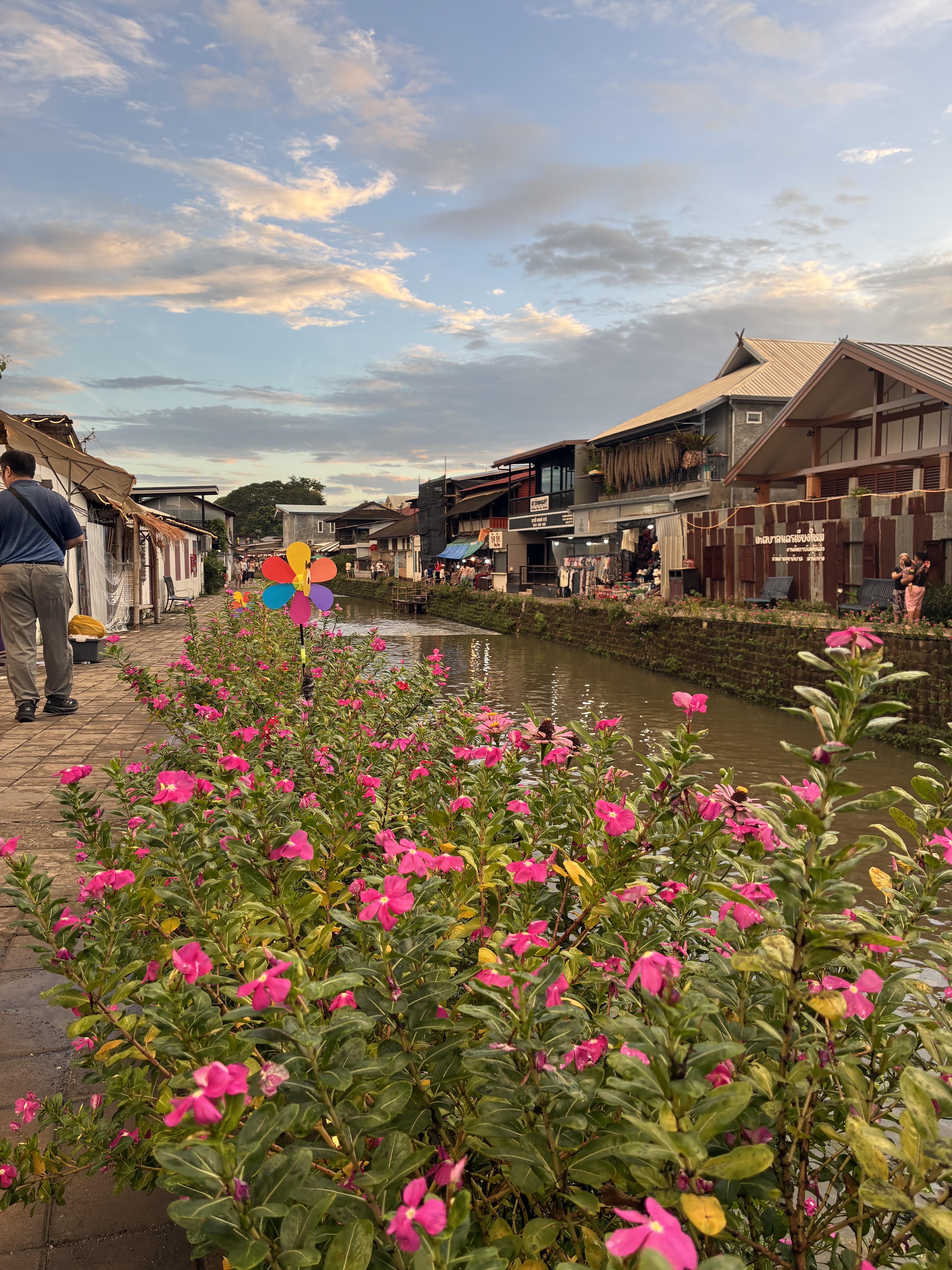
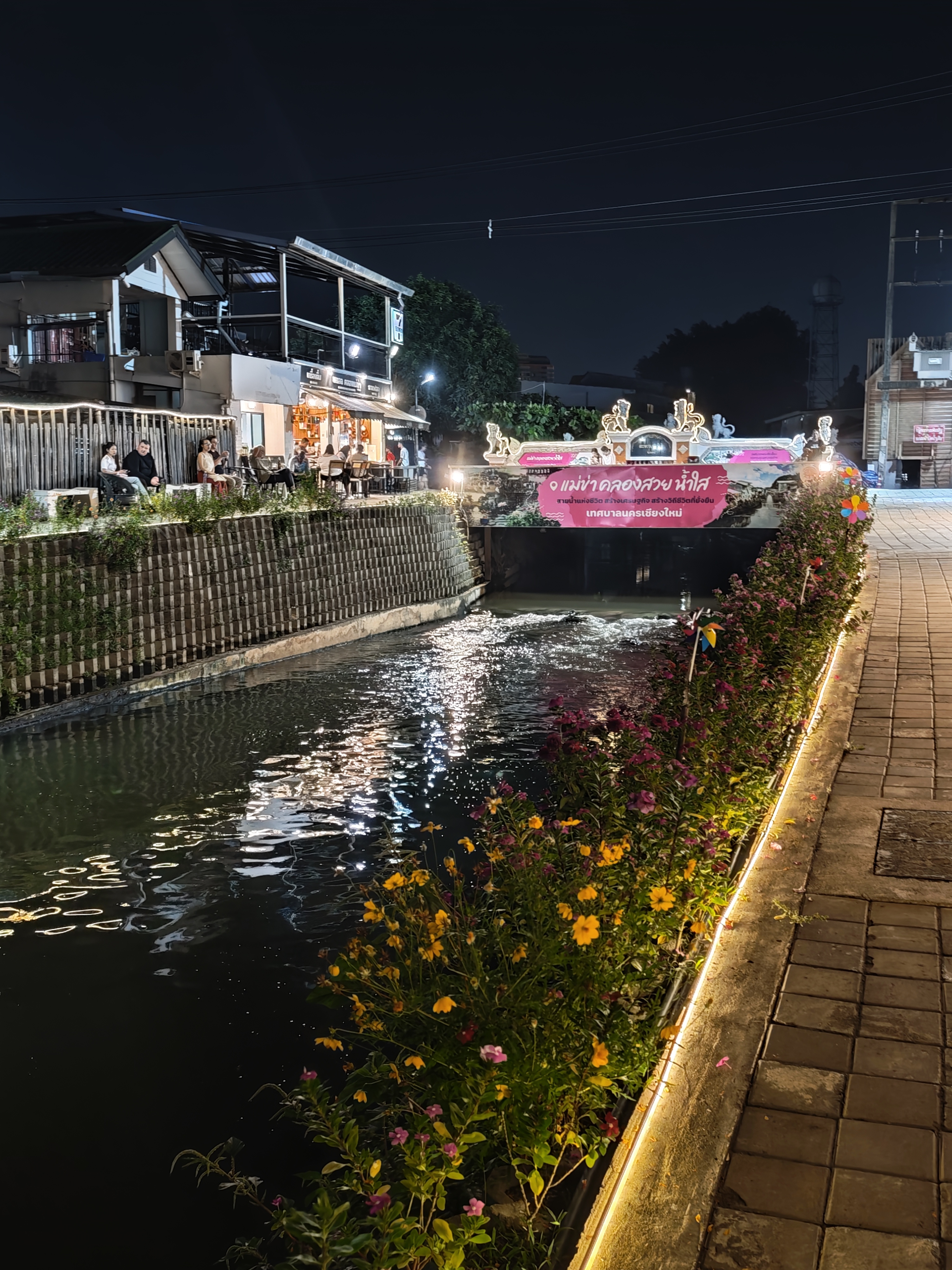
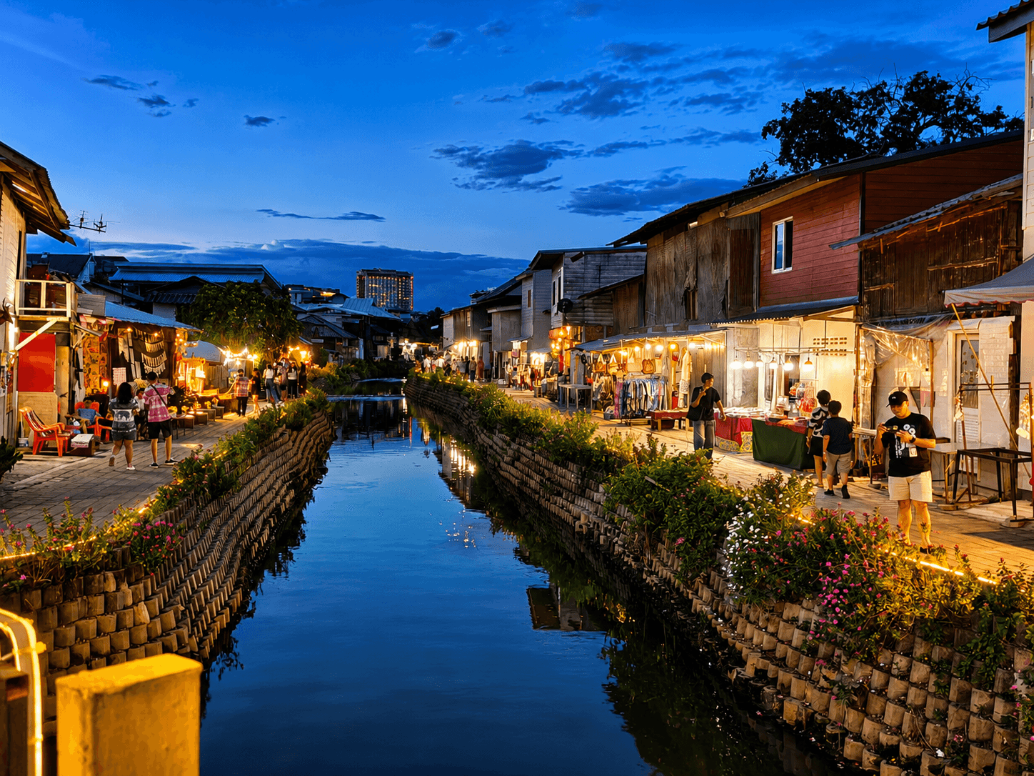
Mae Kha has long formed part of Chiang Mai’s urban water network, helping to drain and shape areas around the historic city.
Urban growth, pollution and neglected banks prompted water-quality and landscape rehabilitation involving public bodies and local communities. The tourist promenade represents just one restored part of a much longer canal.
1. Begin near the restored access by Sri Don Chai Road, check the map and take in the canal and footbridges.
2. Continue at a relaxed pace past small stalls and waterside houses. Pause for reflections without blocking the path.
3. Support a local vendor if you like, then return along the walkway or arrange pickup from an accessible main street.
Late afternoon gives warmer light over the buildings and water. After dusk, look for bridge lights and reflections; their appearance changes with weather and water conditions.
Ask before photographing residents or private shop interiors, and keep doorways and narrow bridges clear.
Mae Kha is part of Chiang Mai’s historic urban water network. Sections became polluted over time, prompting efforts to clean and reclaim the waterway.
Today’s promenade is also a community space. Notice how old and new buildings, local trade and shared access meet along the water.
From Chiang Mai Old City, choose directions from your actual starting point to the restored Mae Kha Canal visitor area.
Songthaews, taxis and ride-hailing can reduce exposure to heat. Parking and drop-off convenience vary with local traffic.
118 Ragang Rd, Haiya Sub-district, Mueang Chiang Mai District, Chiang Mai 50100, Thailand
Open Google Maps ↗Allow roughly 45–90 minutes for a relaxed walk, photographs and a snack.
Yes with close supervision around the water’s edge, bridges and narrow sections.
Visitors often come for the small bridges, canalside houses and evening reflections. Your experience will depend on weather, crowds and which stalls are operating. Check the current rating, review count and dates directly on Google Maps.
Google Maps · Mae Kha Canal ↗Southern Old City gate and a useful orientation point
Explore other guides →Silverwork temple in the traditional Wua Lai craft district
Explore other guides →Saturday market with handicrafts and local snacks
Explore other guides →Well-known eastern entrance to the historic Old City
Explore other guides →Evening shopping and food along Chang Khlan Road
Explore other guides →Traditional Kad Luang market for northern food and gifts
Explore other guides →Monumental historic brick chedi in the Old City
Explore other guides →Lanna temple architecture and golden chedi
Explore other guides →Is Mae Kha Canal open daily? Understand the difference between public promenade access and individual evening-stall opening hours in Chiang Mai.
Find the restored Mae Kha Canal promenade in Chiang Mai, with a map, route planning from the Old City, transport options and parking tips.
Hours may change. Confirm locally and check with individual businesses before making a special trip.
Google Maps · Mae Kha Canal · Tourism Authority of Thailand · Mae Kha rehabilitation research